Debris flows Cortals Encamp
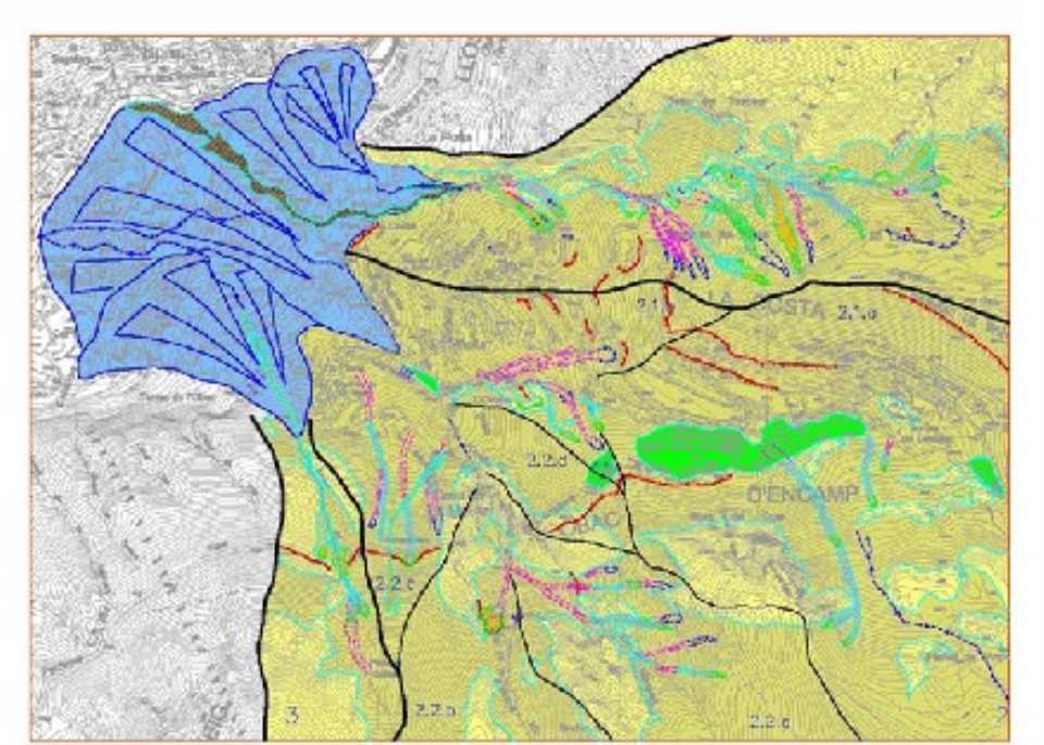
 The study aims to zoning in detail the dangers existing in 1:2000 scale and the determination of a series of recommendations and actions to manage the risk in a rational manner to which it is subjected to the affected area. Risk refers to the currents of detritus, consisting of a mixture of water and solid concrete with a similar liquid.
The methodology is as follows:
1. Photointerpretation preliminary geological study based on observations and general geomorphological field.
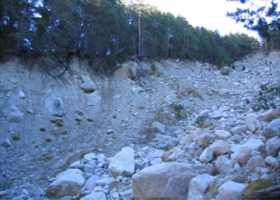
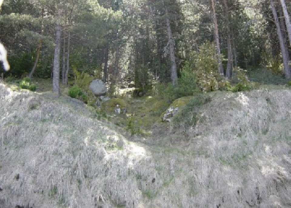
2. Study of activity indicators (the starting area, passage and arrival), inventory of events (heavy rains October 1937 November 1982 floods, other recent events, old events and old events supposedly obvious) and new areas of potential breakdowns.
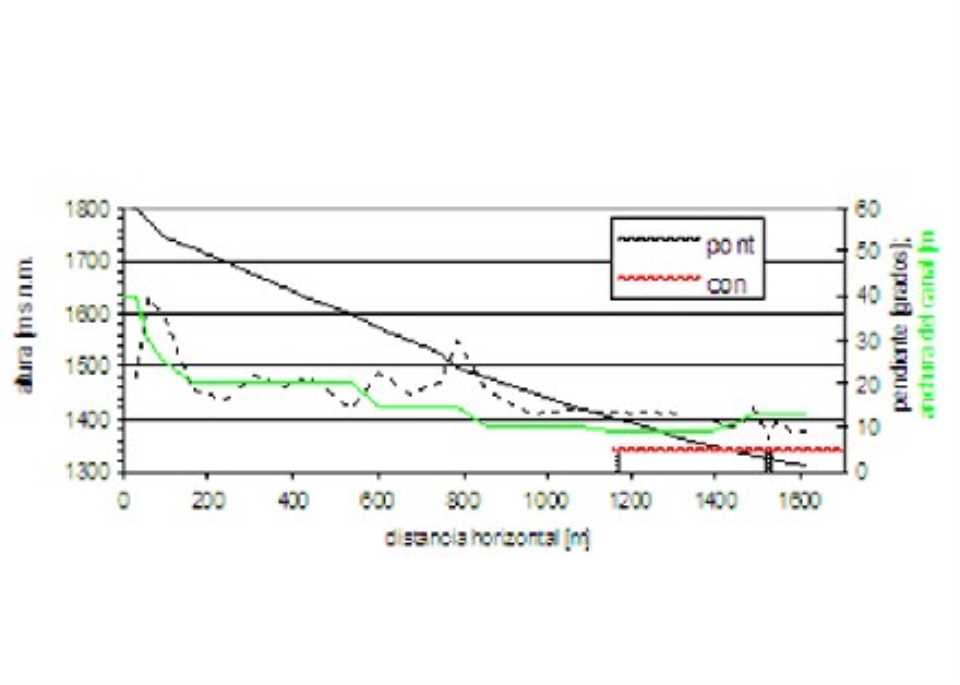
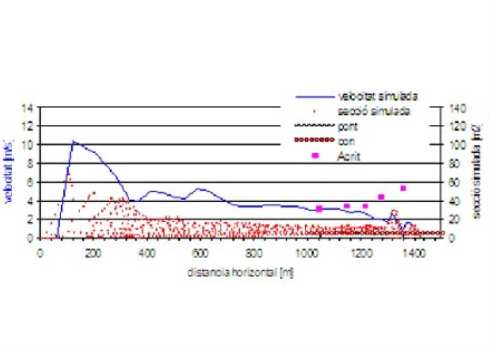
3. Numerical simulation of the process: set the simulation model, the input data to the simulation model (cross sections and longitudinal profile of the channel and the total volumes too detached and estimation of appropriate rheology), the model calibration, the simulation stages and simulation results (probability of manifestation of differents stages, simulation inside the channel and simulation on the debris cone).
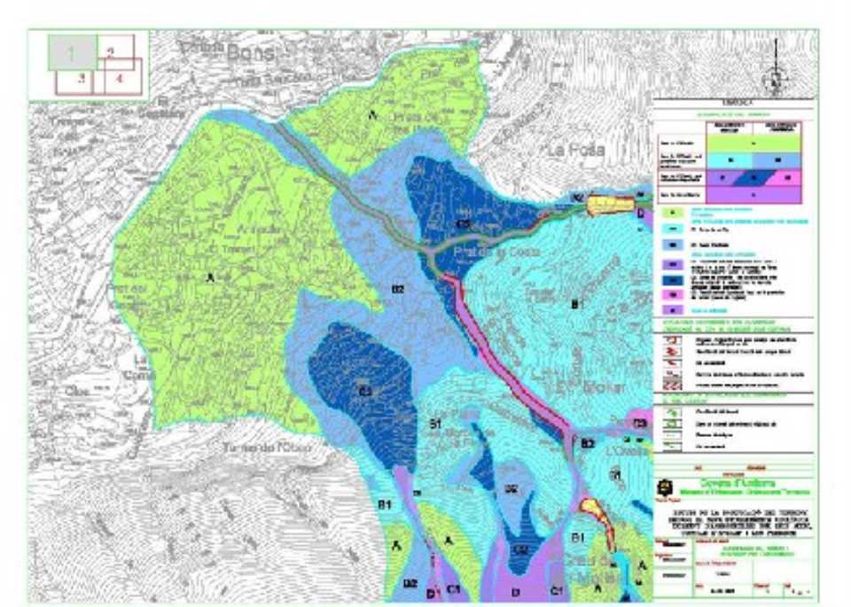
Then set a detailed zoning of the land according to the danger detritus flows, distinguishing between zone and zone out date:
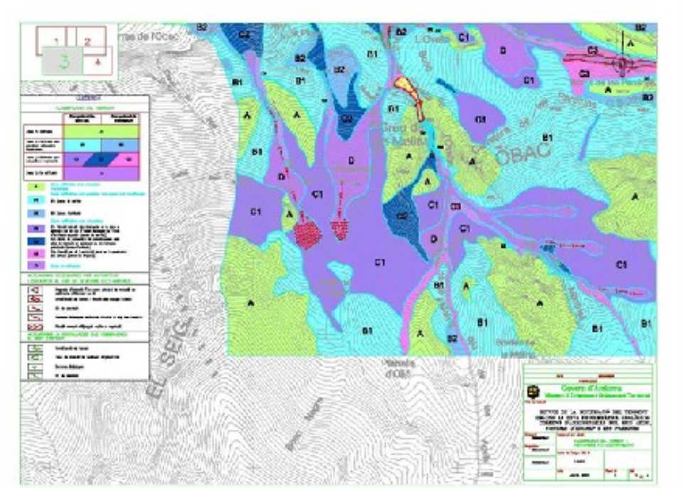
From the study areas were difererenciat regarding the building following the warnings:
Areas A: building without actuations (not likely exposed to currents or detritus).
Areas B: building with possible localized actions (subject to current). Can be divided into:
- Zones B1: possible output currents (a modification of the slope angle of the slope triggering can induce currents).
- Zones B2: possible arrival streams (as a measure of protection, the ground floor can be raised to a certain height over the ground surface).
- Zones C1: situated along the preferred output currents of detritus.
- Zones C2: located in areas of arrival.
- Zones C3: located in areas preferred traject, can be both departure and arrival areas.
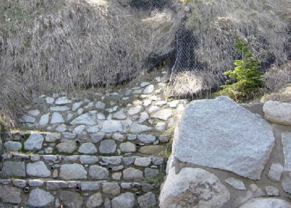
It also establishes a series of proposals for possible action to authorize the construction in areas C2: starting area, commuting, travel and stage performance.
Finally, an estimation is acceptable residual risk (risk after mitigation measures have been implemented).
- Risks to which they are exposed existing buildings: the area with debris from buildings are exposed to the risk that, once implemented protections proposed by the degree of protection required, the buildings located in areas C are under residual risk acceptable.
- Residual risk acceptable in areas not built:
- Zones A: acceptable risk without any action.
- Zones B: acceptable risk by performing, in some cases, protective measures consisting of minor works.
- Zones C: do not allow the construction of buildings essential.
- Zones D: residual risk is not acceptable (not buildable area).